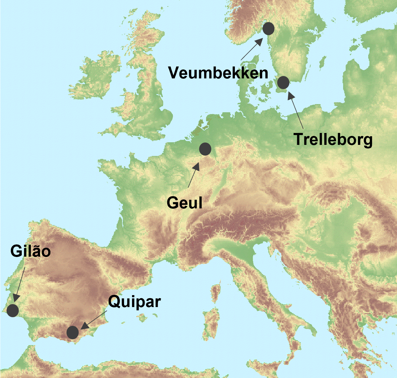
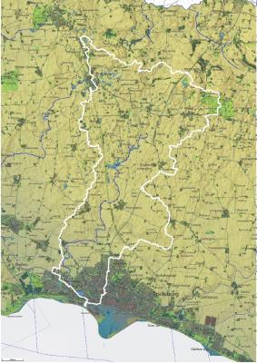
The LandEX project is performed in five study areas in Norway, Portugal, The Netherlands, Spain and Sweden. See the map below for the locations of the study areas.
The LandEX project is performed in five study areas in Norway, Portugal, The Netherlands, Spain and Sweden. See the map below for the locations of the study areas.
The Veumbekken…
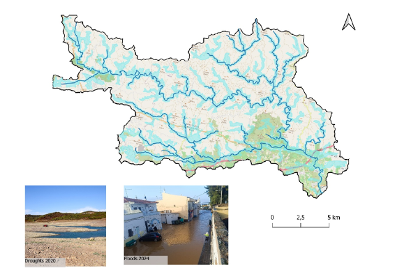
The Gilão catchment is located in the southern region of Portugal. The Gilão River originates northwest of the city of Tavira and consists of three sub-catchments. This area is characterised by a Mediterranean climate with highly variable rainfall patterns. It encompasses diverse land uses, including natural landscapes such as shrublands, forests, agricultural land (e.g., orchards and temporary crops), and urban areas.
The risks associated with the impacts of extreme hydrological phenomena are increasing. Intense precipitation events within the Gilão catchment frequently lead to substantial overland flow and flood damage to local infrastructure and agricultural activities. The region often experiences droughts due to prolonged dry periods, resulting in significant socioeconomic and environmental losses.
To assess the potential of NbS to increase the resilience of the Gilão catchment to the impacts of hydrological extremes, we will use SWAT+ modelling software within the LandEX project.
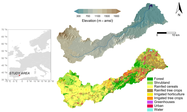
The Quípar catchment (838 km²) is a sub-basin of the Segura River, located in southeastern Spain. It is characterized by a semi-arid Mediterranean climate, with highly variable rainfall, strong seasonality, and a marked west–east gradient from cooler, wetter conditions to hotter, drier ones. The basin receives around 380 mm of annual precipitation and has a mean temperature of 16.4 °C. Hydrologically, it is highly variable: while average discharge at the outlet (Alfonso XIII reservoir) is about 0.35 m³/s, extreme events can occur, such as a 49 m³/s peak flow recorded in 2019.
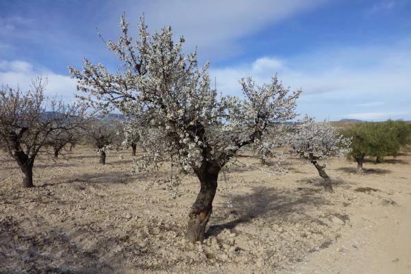
Land use is dominated by extensive rainfed agriculture (mainly cereals and almonds), although there has been a shift from traditional rainfed and pastoral systems towards irrigated crops (horticulture and fruit trees). The low productivity of dryland systems, together with climate change, has driven this intensification, exacerbating challenges such as soil degradation, water scarcity, and rural depopulation.
Semi-structured interviews and participatory workshops have been conducted to gather insights on local perceptions of flood and drought risks, existing management practices, and the effectiveness of both conventional and nature-based measures. Recent workshops focused on the co-development of three future adaptation scenarios, building on the measures identified. Participants included farmers and livestock producers, local and regional authorities, research institutions, environmental NGOs, educators, local communities, and rural development actors.
In this case study, the SPHY (Spatial Processes in HYdrology) model is applied, a spatially-distributed, process-based hydrological model that simulates the most relevant hydrological and soil erosion processes. The SPHY model is used toassess how flood and drought indicators are affected by the three co-developed scenarios under current and future climate conditions.
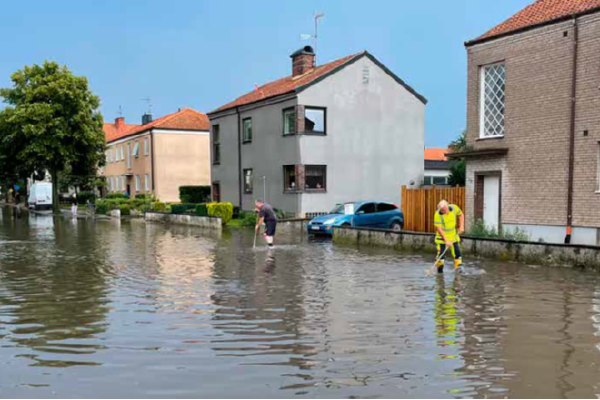
The Ståstorpsån catchment is located in southern Sweden and drains through the municipality of Trelleborg before discharging into the Baltic Sea. The catchment is characterized by a predominantly agricultural upstream landscape, intersected by drainage ditches, small streams, and wetlands, while the downstream reach flows through an urbanized coastal area. This configuration makes Ståstorpsån particularly vulnerable to compound flooding driven by intense rainfall, elevated river discharge, and high sea levels. Flood risk is further amplified by the low topography near the river mouth, limited hydraulic gradients, and the interaction between the river and the urban stormwater system.
Within the LandEX project, the Ståstorpsån case study is used to investigate how land-use practices and nature-based solutions (NBS) influence flood and drought resilience under present and future climate conditions. An integrated hydrological–hydraulic modelling framework has been developed (river, catchment, and urban drainage components), building on existing municipal and consultancy models and long-term hydro-meteorological data. The model represents rainfall–runoff generation in upstream sub-catchments, river hydraulics along Ståstorpsån, and boundary conditions from both the urban drainage network and the Baltic Sea. Current work focuses on identifying hydrological and hydraulic hotspots, such as flood-prone reaches near culverts, bridges, wetlands, and the river outlet, where backwater effects from high sea levels are significant. Scenario analyses are being used to assess the effectiveness of existing and planned wetlands, ponds, and other NBS in attenuating peak flows, increasing temporary water storage, and reducing downstream flood extents. The case study provides practical insights into how upstream measures can contribute to coastal flood risk reduction and supports the co-development of spatially explicit, evidence-based strategies for resilient land and water management in low-lying coastal catchments.
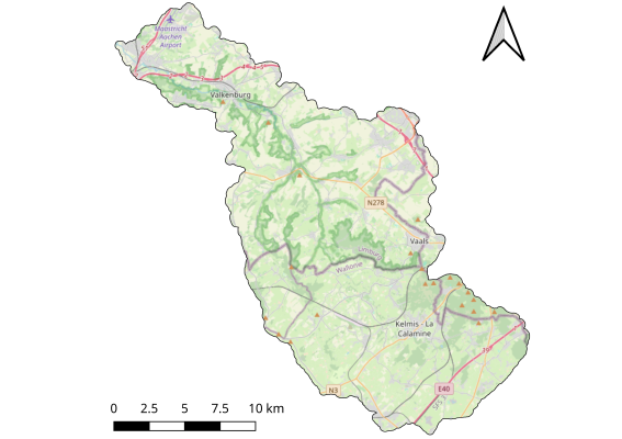
The Geul river is a tributary of the Meuse and flows through the loess hill area in Germany, Belgium and the Netherlands. Agriculture, recreation and nature all share in the land cover, and many villages and towns are spread over the hills and in the valleys of the Geul catchment.
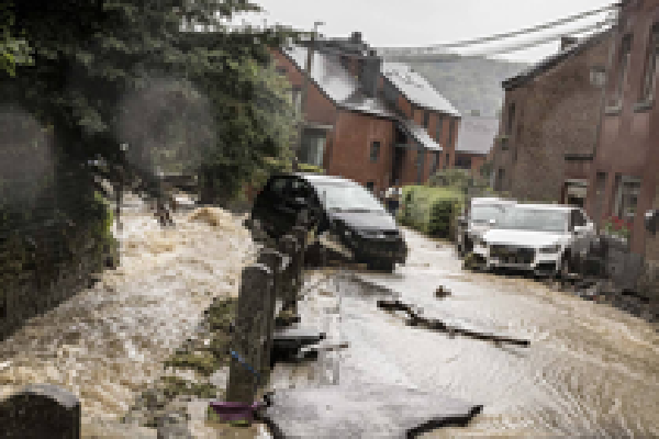
Intensive rainfall events often cause flooding problems from local scale of flooded basements to larger scale flooding of the whole valley bottom. In the summer of 2021 floods occurred in a larger region in Germany and Belgium, and also the Geul catchment experienced extremely high water levels. On the other hand, longer periods without rain create challenges for nature areas as well as for agriculture to prevent loss of biodiversity or crop production.
Within the LandEX project we will use the OpenLISEM model to explore the potential of NBS to increase the resilience of the Geul catchment to flood and droughts.